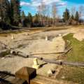
TahoeGirl’s blog has a trip report and photos from her backcountry hike into the Desolation Wilderness this weekend. The Desolation Wilderness is located in the mountains to the southwest of Lake Tahoe, and it’s known for being dotted with lakes and gorgeous scenery. I went through a brief phase of being a backcountry hiker myself about a decade ago, and I went into Desolation a few times. But my one regret is that I never made it to Lake Aloha, which is the largest, and from all the pictures I’ve seen probably the most striking, of all the backcountry lakes in the area. TahoeGirl, of course, managed to make it there.
Lake Aloha sprawls over a rocky basin at an 8,000-foot elevation, seemingly at the top of the world. Lake Aloha is actually partially a man-made lake, dammed as part of the Sacramento reservoir system. This allows for wild fluctuations in the depth of the lake, as more water is stored in Aloha during the spring, and then slowly released as the year goes on. And since Aloha is pretty shallow to begin with, as the water level drops all these interesting islands and bays appear, creating the landscape that you can see in the picture above.
Lake Aloha butts right up against the Pacific Crest Trail and Tahoe Rim Trail, so there are a few ways of getting there, depending on what kind of mood you’re in. The shortest path is to drive up to Echo Lake, off of Hwy 50 at Echo Summit, and hike in from there. But supposedly the most scenic route is to start at the far end of Fallen Leaf Lake and take the trail you find there. Or of course you could start at any of the numerous Tahoe Rim Trail trailheads around the lake, and given enough hiking, you’ll find yourself at Aloha sooner or later. There are a bunch of maps online and an excellent book that can tell you exactly how to get there if you’re interested. And if you go, take a picture for me!
TahoeGirl has an entire Hiking Lake Tahoe set on Flickr, and more pictures of Lake Aloha can be found here.


